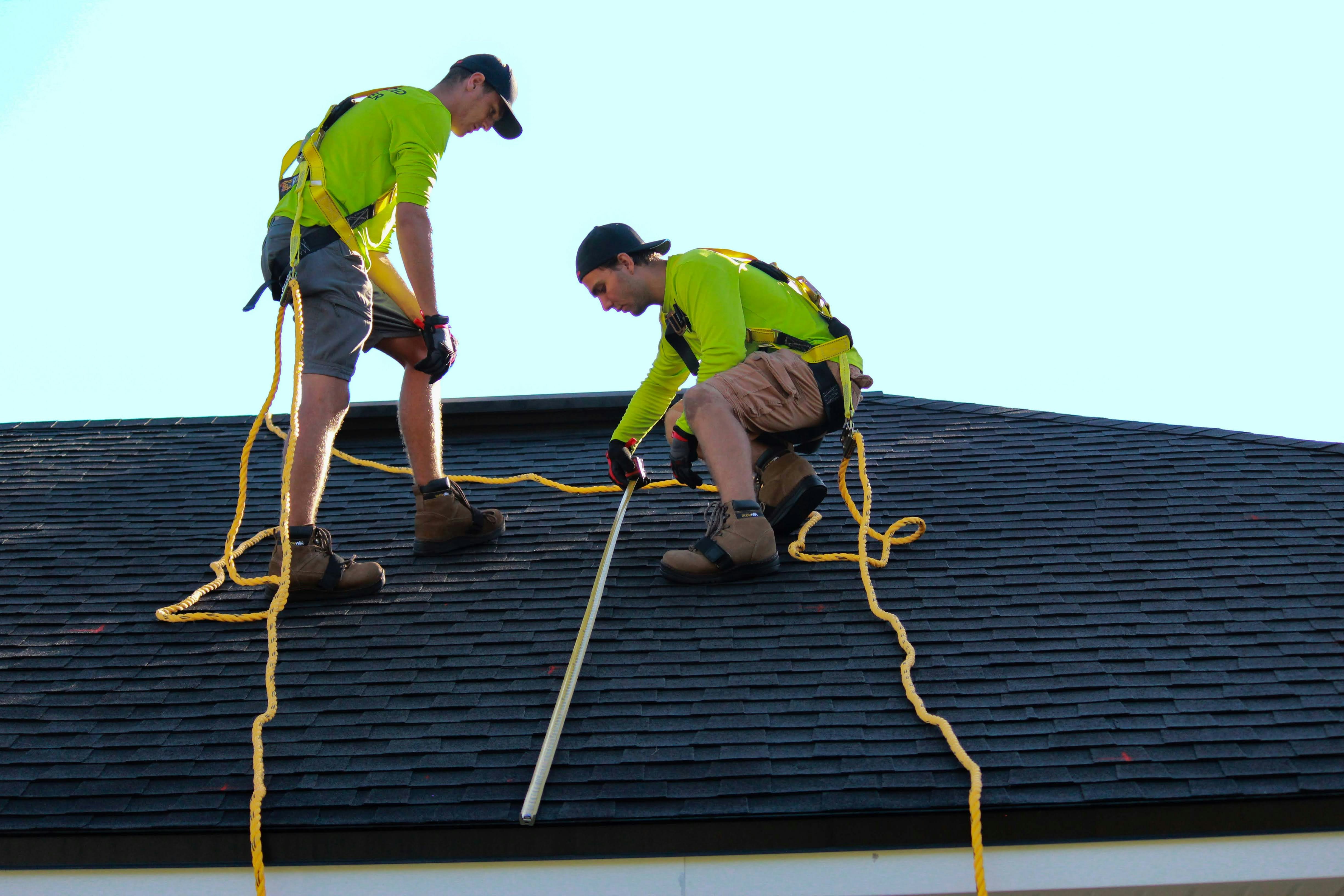
Let’s be real for a second. Climbing up on a steep, slippery roof with a tape measure in hand is flat-out dangerous. If you want a safer and faster way to get accurate estimates, an aerial roof measurement is the solution you need. If you are a contractor, insurance adjuster, or material supplier, you already know the drill. You spend hours driving to a site, pulling out the heavy ladder, and risking a serious fall just to get some basic numbers.
On top of the safety risks, your valuable time is going down the drain. Think about how long it takes to measure a complex property by hand. And what happens if those handwritten numbers are slightly off? Inaccurate estimates lead to ordering too little material, delaying the project, or ordering too much and eating the extra cost. Ultimately, doing things the old-fashioned way means your overall costs go way up.
But what if you never had to climb a roof for an estimate again? Thanks to modern technology, the days of manual measuring are fading fast. There is a much safer, faster, and highly accurate way to handle your estimates without ever leaving your desk. Let’s talk about how embracing digital tools can completely transform your workflow, saving you serious time, money, and stress.
The Hidden Costs of Doing It the Old-Fashioned Way
Before we talk about the solution, we have to look at why the traditional method is holding your business back. Manual measurement is a grind, and it comes with hidden costs that eat into your profit margins every single day.
First and foremost is the physical risk. Walking a roof, especially one with a steep pitch or weather damage, is hazardous. A single slip can lead to life-altering injuries and massive liability issues for your business. It simply isn’t worth the risk when safer alternatives exist.
Then, there is the massive waste of time. Driving from property to property, setting up equipment, carefully walking the perimeter, and jotting down notes can take hours for just one house. If you are trying to bid on multiple jobs in a single day, this bottleneck severely limits how much work you can actually take on.
Finally, human error is unavoidable. It is incredibly easy to miscalculate a pitch, miss a small dormer, or round a number incorrectly. These inaccurate estimates cause major headaches during the installation phase. You either end up pausing the job to run out for more shingles, or you over-order and lose money on wasted supplies.
Enter the Era of Aerial Roof Measurement
So, what is the alternative? The industry is rapidly shifting toward satellite and drone imagery. Instead of pulling out a ladder, you can now pull up high-resolution imagery of a property from the comfort of your office or your truck.
An aerial roof measurement uses advanced satellite data and specialized software to calculate the exact dimensions of a structure. The technology maps out the entire exterior, taking the guesswork out of your estimates.
This approach completely eliminates the need for site visits just to get measurements. By utilizing high-tech aerial imagery, you get crystal-clear visibility of the property. You can see every ridge, valley, and slope without ever taking your feet off the ground.
How Aerial Roof Measurement Boosts Remote Quoting
One of the biggest advantages of this technology is the ability to offer remote quoting. When a potential client calls you for an estimate, you no longer have to tell them you will be out in three days to take a look.
Instead, you can request an aerial roof measurement and have the data in your hands incredibly fast. This fast turnaround means you can deliver a professional, accurate quote to the homeowner before your competitors even have a chance to schedule a site visit. In today’s fast-paced market, the first person to deliver a solid quote often wins the job.
Beyond winning more bids, the cost savings are undeniable. You spend less money on gas, reduce wear and tear on your vehicles, and free up your sales team to focus on closing deals instead of playing acrobat on a roof. Accuracy means your material orders are spot on, completely eliminating the financial drain of inaccurate estimates.
A Game-Changer for Contractors, Insurance Agents, and Suppliers
This technology isn’t just for one type of professional. It is revolutionizing the entire exterior property industry. Here is a look at how different segments are using it to make their daily lives easier:
Contractors: You can scale your business faster. By getting exact measurements remotely, you can pump out more bids in less time. Your crews know exactly what they are walking into, and your material orders are perfect every time.
Insurance Agents: After a major storm, adjusters are swamped with claims. Walking dozens of damaged roofs a week is dangerous and exhausting. Aerial imagery allows you to verify the square footage and roof complexity safely, processing claims much faster and keeping policyholders happy.
Material Suppliers: When a contractor comes to you for an order, having access to precise measurements ensures you supply the exact amount of siding, shingles, and drip edge needed. It builds trust with your buyers and streamlines your delivery logistics.
What to Expect from a Professional Aerial Roof Measurement Report
When you make the switch to a digital solution, you aren’t just getting a couple of basic numbers jotted on a digital notepad. A professional aerial roof measurement provides a comprehensive, easy-to-read package that your whole team can rely on.
Typically, this data is compiled into a highly detailed, nine-page report. This report is meticulously designed to give you every piece of exterior data you need to order materials and plan the job. Note that these reports focus purely on exterior measurements and material takeoffs—they are built for ordering and quoting, leaving things like structural framing repairs or CAD architectural drafting to the engineers.
Here is exactly what you can expect to find inside the report:
Total Squares: The exact surface area of the roof, completely eliminating the guesswork from your shingle or metal panel orders.
Roof Edgings and Folds: Precise linear footage for your ridges, valleys, eaves, and rakes. This ensures you order the perfect amount of starter strip, ridge cap, and drip edge.
Roof Planes and Characteristics: A breakdown of each individual section of the roof, including the pitch and area of every single facet.
Color-Coded and Dimensioned Drawing: A clean, easy-to-read visual map of the roof. Your installation crew can use this color-coded guide on the job site to understand exactly how the roof is laid out.
High-Resolution Aerial Imagery: Clear photos of the structure from multiple angles, giving you a perfect visual reference of the property’s condition and layout.
Working Smarter, Not Harder
At the end of the day, doing business the hard way doesn’t win you any extra awards. It just tires you out and limits your growth. Manual measurements are a thing of the past—they are risky, time-consuming, and prone to costly mistakes.
By embracing satellite and drone imagery, you are choosing to work smarter. You can provide incredibly fast turnarounds, guarantee pinpoint accuracy, and unlock the power of remote quoting. Whether you are trying to close a massive commercial bid or just streamline your daily residential quotes, discover how an aerial roof measurement can simplify your workflow, protect your profit margins, and keep your feet safely on the ground.